Location-aware information
Each incident can include location, photo, category, priority and enough context to act.
A citizen report can become a chain of calls, emails and manual tasks. A well-designed platform can turn that process into one coordinated, traceable workflow.
Concept · Municipal management
Incidents and services dashboard
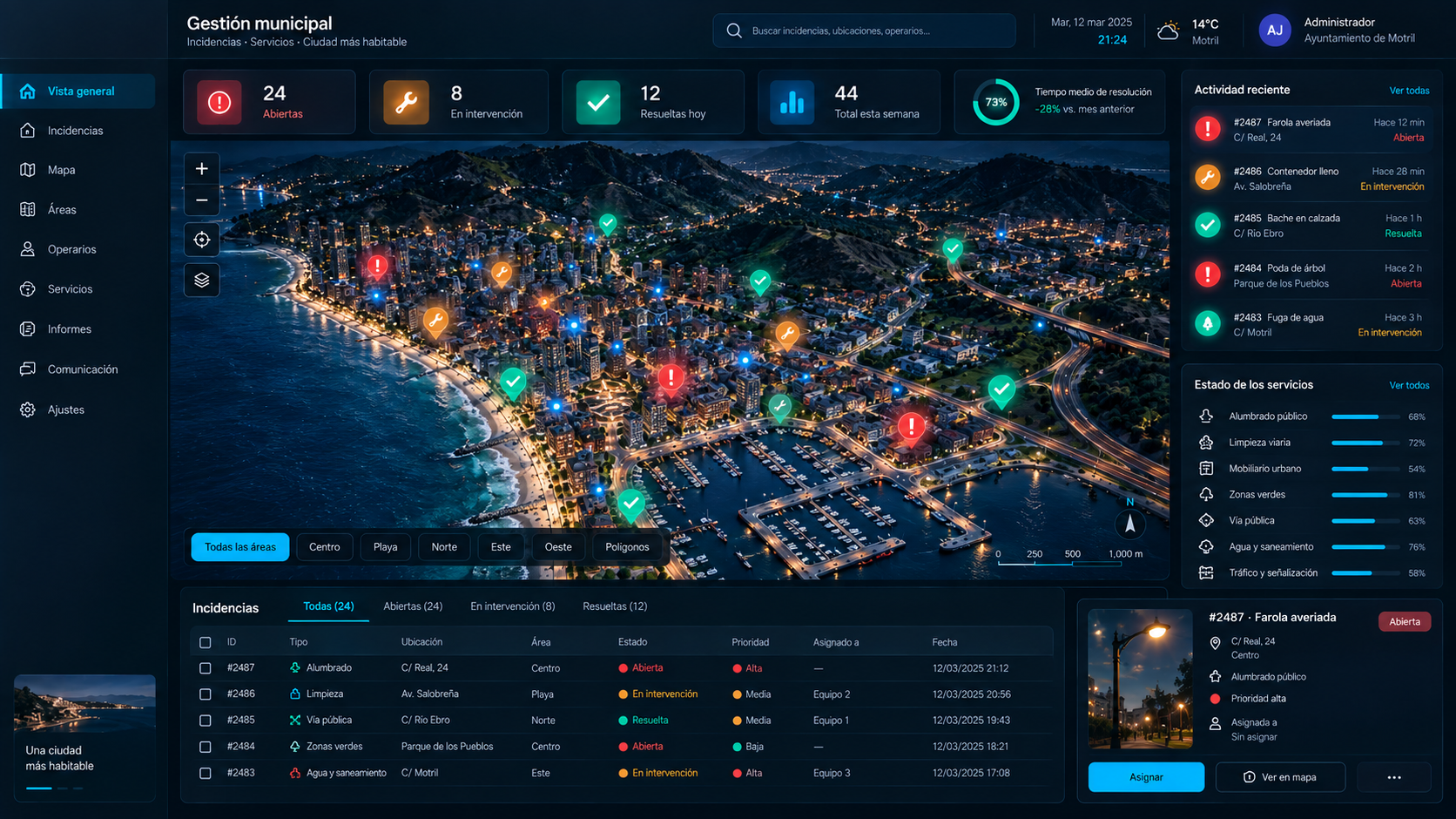
From problem to process
The goal is not to add another tool to a municipality. It is to connect the parts of the process that already exist and remove manual work where technology can create a real improvement.
Incident workflow
From report to resolution, without losing context.
Reports an issue from a mobile device with photo, location and description.
Receives, classifies and validates the report before routing it to the appropriate area.
Assigns the work to the appropriate team and follows its progress.
Receives the task, goes to the location and updates the status from the field.
Receives the update and can check the result of the report.
Incident resolved
The citizen receives the update.
Location
C/ Real, 24
Evidence
Photo attached
Status
Full traceability
Each incident can include location, photo, category, priority and enough context to act.
The incident reaches the appropriate area and team without relying on informal communication chains.
Status and history make it possible to know what happened, who acted and what remains pending.
Possible areas
The concept can adapt to each municipality’s organization and responsibilities. These are example categories, not modules currently sold by Azoteverse.
Solution concept
We do not present this platform as an already-available municipal product. It is a conceptual example showing how Azoteverse can analyze a problem, design the workflow and turn it into a digital tool when the solution is technically and economically reasonable.
Custom solutions
Tell us how the process works today. We will study the problem before talking about technology.